Puerto de Ushuaia
Official provincial port source for Ushuaia passenger-port context.


Cruise planning
Use the timetable to see upcoming cruise ship calls, busy-day signals, ship counts, and port context alongside the guide, map, weather, and readiness tools.
Schedule note
Port schedules can change because of weather, berth availability, itinerary updates, and operational decisions. Verify important times with your cruise line or the port authority before travel.
Country, code, and on-shore essentials.
Argentina
ARUSH
-54.802, -68.303
Hotel search loads here when you reach this section.
VoyagePro may earn a commission if you book through Expedia, at no extra cost to you.


Ushuaia cruise berths are close to the compact city waterfront and expedition-cruise services.
Before going ashore, confirm the berth or tender point, local time, all-aboard deadline, and the meeting location for any independently booked transport or tour.
Usually docks
Walkable
Independent town visits are practical; nature excursions need weather-aware timing.
This port works best when you confirm the exact arrival point, choose one coherent plan, and protect the return to the ship with a comfortable time buffer.
Best for
Needs extra planning when
This section draws on information from Puerto de Ushuaia and Ushuaia Turismo.
Confirm the actual berth first—local access can change substantially between terminals.
Ships normally use Ushuaia's long commercial pier on the downtown waterfront, although berth space can change the exact gangway position. Expedition vessels may also use smaller-boat procedures, so follow the ship's final instructions.
The visitor waterfront and central shops are roughly a 5–10 minute walk from the pier exit. Tierra del Fuego National Park, the End of the World Train, and outlying trailheads require a taxi, transfer, or timed excursion.
Cruise-line tours and expedition transfers vary by sailing.
Taxi and tour transfer are practical for national park and out-of-town plans.
This section draws on information from Puerto de Ushuaia and Ushuaia Turismo.
A concise summary of useful details found in port, municipal, transport, terminal, and tourism material.
Puerto de Ushuaia
Official provincial port source for Ushuaia passenger-port context.
Ushuaia Turismo
Official visitor source for Ushuaia planning.
This section draws on information from Puerto de Ushuaia and Ushuaia Turismo.
Start with the usable time you have ashore, then leave a comfortable return margin.
Quick call
Keep the day close to the port and choose one or two reliable nearby stops.
Half day
Ushuaia waterfront, town center, Tierra del Fuego National Park, and Beagle Channel tours are common planning points. The visitor waterfront and central shops are roughly a 5–10 minute walk from the pier exit. Tierra del Fuego National Park, the End of the World Train, and outlying trailheads require a taxi, transfer, or timed excursion.
Long call
Ushuaia waterfront, town center, Tierra del Fuego National Park, and Beagle Channel tours are common planning points. Keep the ship's all-aboard time as a hard deadline and allow extra time for weather, traffic, queues, security, or tender operations.
This section draws on information from Puerto de Ushuaia and Ushuaia Turismo.
Weather, wind, and outdoor terrain can affect mobility.
This section draws on information from Puerto de Ushuaia and Ushuaia Turismo.
Keep the ship's all-aboard time as a hard deadline and allow extra time for weather, traffic, queues, security, or tender operations.
This section draws on information from Puerto de Ushuaia and Ushuaia Turismo.
These answers use the reviewed operational fields above; check the linked source when a detail affects a booking or transfer.
Ships normally use Ushuaia's long commercial pier on the downtown waterfront, although berth space can change the exact gangway position. Expedition vessels may also use smaller-boat procedures, so follow the ship's final instructions.
The visitor waterfront and central shops are roughly a 5–10 minute walk from the pier exit. Tierra del Fuego National Park, the End of the World Train, and outlying trailheads require a taxi, transfer, or timed excursion.
Cruise-line tours and expedition transfers vary by sailing. Taxi and tour transfer are practical for national park and out-of-town plans.
Independent town visits are practical; nature excursions need weather-aware timing.
This section draws on information from Puerto de Ushuaia and Ushuaia Turismo.
Guide review and sources
Operational details can change by berth, weather, and ship call. Confirm important arrangements before travel.
Choose a few places that fit your time ashore, then check access and transport before setting out.
The visitor waterfront and central shops are roughly a 5–10 minute walk from the pier exit. Tierra del Fuego National Park, the End of the World Train, and outlying trailheads require a taxi, transfer, or timed excursion.
Arrival location reference

Local landmark
A source-backed option to consider for a port day in Ushuaia.
A source-backed option to consider for a port day in Ushuaia. Check current access, opening hours, admission requirements, and reservations before setting out.
This is near the destination reference, but the practical walking route still depends on the assigned berth or tender landing.
Near the destination reference; confirm the walking route
Local landmark
A source-backed option to consider for a port day in Ushuaia.
A source-backed option to consider for a port day in Ushuaia. Check current access, opening hours, admission requirements, and reservations before setting out.
Use the official visitor information for directions. No sufficiently reliable geotagged match was found, so this place is intentionally not pinned.

Nature and park
A source-backed option to consider for a port day in Ushuaia.
A source-backed option to consider for a port day in Ushuaia. Check current access, opening hours, admission requirements, and reservations before setting out.
Treat this as a longer outing and protect the ship return with confirmed transport and a generous time margin.
Longer outing; confirmed transport recommended
Reviewed 2026-07-25. Location placement, transport, and attraction information retain separate sources so each can be checked and updated independently.
Choose an upcoming call and ship to turn the published schedule into a practical planning window.
Choose a call date
Choose your ship

Your selected call
Arrival
Not published
Departure
6:00pm
Scheduled window
Not published
Planning return buffer
Count back from the published departure time.
Planning checkpoint: 4:30pm
This is a personal planning checkpoint, not the ship's official all-aboard time. Always follow the time and instructions issued onboard.
Guide match for this window
Confirm your ship's times, then choose one coherent local plan with a comfortable return margin.
Dates, ships, and times come from the currently published cruise-call records. Schedules can change, and passenger totals represent available ship-capacity data rather than a forecast of people going ashore.
At 55 degrees latitude south, Ushuaia (pronounced oo-swy-ah) is closer to the South Pole than to Argentina's northern border with Bolivia. It is the capital and tourism base for Tierra del Fuego, the island at the southernmost tip of Argentina. Although its stark physical beauty is striking, Tierra del Fuego's historical allure is based more on its mythical past than on rugged reality. The island was inhabited for 6,000 years by Yámana, Haush, Selk'nam, and Alakaluf Indians.
But in 1902 Argentina, eager to populate Patagonia to bolster its territorial claims, moved to initiate an Ushuaian penal colony, establishing the permanent settlement of its most southern territories and, by implication, everything in between. When the prison closed in 1947, Ushuaia had a population of about 3,000, made up mainly of former inmates and prison staff. Today the Indians of Darwin's "missing link" theory are long gone—wiped out by diseases brought by settlers and by indifference to their plight—and the 60,000 residents of Ushuaia are hitching their star to tourism. The city rightly (if perhaps too loudly) promotes itself as the southernmost city in the world (Puerto Williams, a few miles south on the Chilean side of the Beagle Channel, is a small town).
You can make your way to the tourism office to get your clichéd, but oh-so-necessary, "Southernmost City in the World" passport stamp. Ushuaia feels like a frontier boomtown, at heart still a rugged, weather-beaten fishing village, but exhibiting the frayed edges of a city that quadrupled in size in the '70s and '80s and just keeps growing. Unpaved portions of Ruta 3, the last stretch of the Pan-American Highway, which connects Alaska to Tierra del Fuego, are finally being paved. The summer months (December through March) draw more than 120,000 visitors, and dozens of cruise ships.
The city is trying to extend those visits with events like March's Marathon at the End of the World and by increasing the gamut of winter activities buoyed by the excellent snow conditions. A terrific trail winds through the town up to the Martial Glacier, where a ski lift can help cut down a steep kilometer of your journey. The chaotic and contradictory urban landscape includes a handful of luxury hotels amid the concrete of public housing projects. Scores of "sled houses" (wooden shacks) sit precariously on upright piers, ready for speedy displacement to a different site.
But there are also many small, picturesque homes with tiny, carefully tended gardens. Many of the newer homes are built in a Swiss-chalet style, reinforcing the idea that this is a town into which tourism has breathed new life. At the same time, the weather-worn pastel colors that dominate the town's landscape remind you that Ushuaia was once just a tiny fishing village, snuggled at the end of the Earth. As you stand on the banks of the Canal Beagle (Beagle Channel) near Ushuaia, the spirit of the farthest corner of the world takes hold.
What stands out is the light: at sundown the landscape is cast in a subdued, sensual tone; everything feels closer, softer, and more human in dimension despite the vastness of the setting. The snowcapped mountains reflect the setting sun back onto a stream rolling into the channel, as nearby peaks echo their image—on a windless day—in the still waters. Above the city rise the last mountains of the Andean Cordillera, and just south and west of Ushuaia they finally vanish into the often-stormy sea. Snow whitens the peaks well into summer. Nature is the principal attraction here, with trekking, fishing, horseback riding, wildlife spotting, and sailing among the most rewarding activities, especially in the Parque Nacional Tierra del Fuego (Tierra del Fuego National Park).
Keep exploring
 eSIM for travellers
Use a GigSky travel eSIM for maps, messaging, and travel updates ashore. Choose a plan that covers the countries you will visit.
Land plans do not include at-sea coverage. Check destination coverage and phone compatibility before buying.
VoyagePro may earn a commission if you buy through this link, at no extra cost to you.
Explore tour options for your port day. Check the meeting point and return time against your ship’s schedule before booking.
Excursion partner

Independent shore excursions
Select any tour card to view current details, availability, and booking on the Shore Excursions Group website.
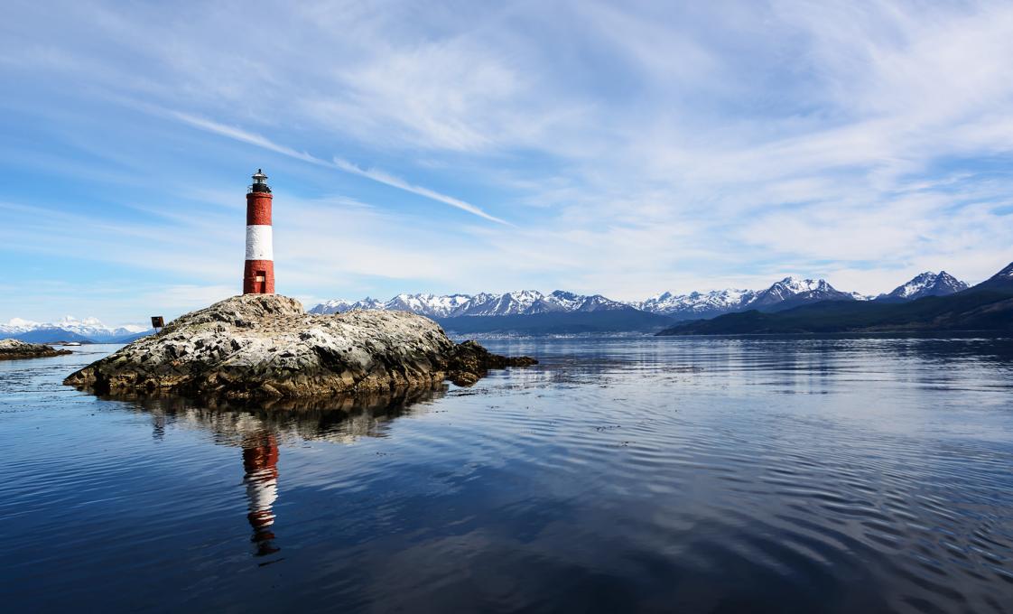
Discover rare sea lions and coastal birds from the comfort of a catamaran at the "End of The World,' on this nautical Tierra del Fuego tour.
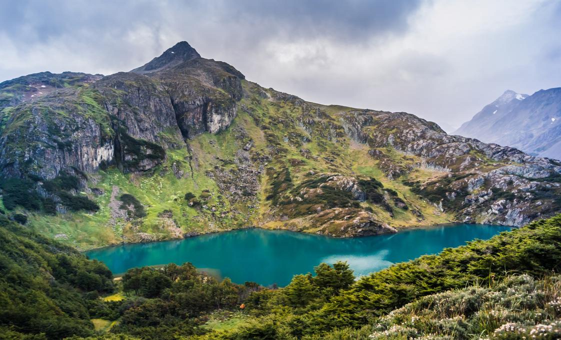
Delight in the tranquil atmosphere created by nature near the southern tip of Argentina. Pristine Andes mountains, placid lakes, and Patagonic Forest welcome you on this Tierra del Fuego National Park tour.
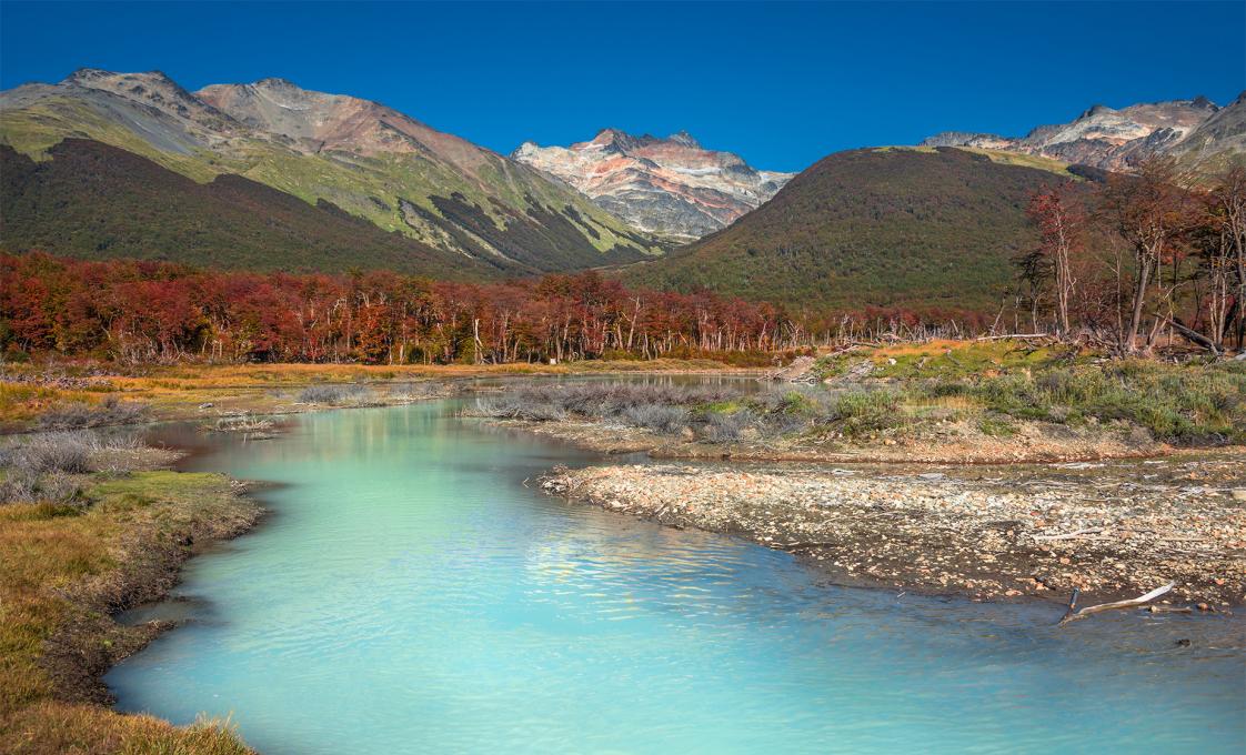
Delight in the tranquil atmosphere created by nature near the southern tip of Argentina. Pristine Andes mountains, placid lakes, and Patagonic Forest welcome you on this Tierra del Fuego tour.
VoyagePro may earn a commission if you book through these links, at no extra cost to you.
Place photos are resized for display and cropped where needed.
