Costa Maya Port
Official terminal source for Costa Maya cruise-port facilities.


Cruise planning
Use the timetable to see upcoming cruise ship calls, busy-day signals, ship counts, and port context alongside the guide, map, weather, and readiness tools.
Schedule note
Port schedules can change because of weather, berth availability, itinerary updates, and operational decisions. Verify important times with your cruise line or the port authority before travel.
Country, code, and on-shore essentials.
Mexico
MXCOM
18.733, -87.693
Hotel search loads here when you reach this section.
VoyagePro may earn a commission if you book through Expedia, at no extra cost to you.
Costa Maya cruise calls use a purpose-built cruise port outside Mahahual.
Before going ashore, confirm the berth or tender point, local time, all-aboard deadline, and the meeting location for any independently booked transport or tour.
Usually docks
Shuttle recommended
Independent visits are practical if transport and return timing are clear.
This port works best when you confirm the exact arrival point, choose one coherent plan, and protect the return to the ship with a comfortable time buffer.
Best for
Needs extra planning when
This section draws on information from Costa Maya Port and Mexican Caribbean.
Confirm the actual berth first—local access can change substantially between terminals.
Ships berth at Costa Maya's purpose-built cruise complex. The pier walk can be long, and transport departures begin outside the controlled terminal area, so follow the signed exit and return route.
Pools, shops, and the cruise-center facilities are at the pier. Mahahual is roughly 3–4 km away, usually 10–15 minutes by taxi or shuttle; beaches beyond town and Maya sites require a prearranged vehicle or tour.
Cruise-line excursions, local shuttles, and beach transfers vary by sailing.
Taxi and tour transfer are practical for Mahahual, beach clubs, and ruins excursions.
Airport transfers are not normally a simple same-day cruise-port move.
This section draws on information from Costa Maya Port and Mexican Caribbean.
A concise summary of useful details found in port, municipal, transport, terminal, and tourism material.
Costa Maya Port
Official terminal source for Costa Maya cruise-port facilities.
Mexican Caribbean
Official tourism source for regional visitor planning.
This section draws on information from Costa Maya Port and Mexican Caribbean.
Start with the usable time you have ashore, then leave a comfortable return margin.
Quick call
Keep the day close to the port and choose one or two reliable nearby stops.
Half day
Cruise-port facilities, Mahahual, beach clubs, snorkeling, and Maya ruins excursions are common planning points. Pools, shops, and the cruise-center facilities are at the pier. Mahahual is roughly 3–4 km away, usually 10–15 minutes by taxi or shuttle; beaches beyond town and Maya sites require a prearranged vehicle or tour.
Long call
Cruise-port facilities, Mahahual, beach clubs, snorkeling, and Maya ruins excursions are common planning points. Keep the ship's all-aboard time as a hard deadline and allow extra time for weather, traffic, queues, security, or tender operations.
This section draws on information from Costa Maya Port and Mexican Caribbean.
Heat, pier distance, and transfer boarding points can affect mobility.
This section draws on information from Costa Maya Port and Mexican Caribbean.
Keep the ship's all-aboard time as a hard deadline and allow extra time for weather, traffic, queues, security, or tender operations.
This section draws on information from Costa Maya Port and Mexican Caribbean.
These answers use the reviewed operational fields above; check the linked source when a detail affects a booking or transfer.
Ships berth at Costa Maya's purpose-built cruise complex. The pier walk can be long, and transport departures begin outside the controlled terminal area, so follow the signed exit and return route.
Pools, shops, and the cruise-center facilities are at the pier. Mahahual is roughly 3–4 km away, usually 10–15 minutes by taxi or shuttle; beaches beyond town and Maya sites require a prearranged vehicle or tour.
Cruise-line excursions, local shuttles, and beach transfers vary by sailing. Taxi and tour transfer are practical for Mahahual, beach clubs, and ruins excursions.
Independent visits are practical if transport and return timing are clear.
Airport transfers are not normally a simple same-day cruise-port move.
This section draws on information from Costa Maya Port and Mexican Caribbean.
Guide review and sources
Operational details can change by berth, weather, and ship call. Confirm important arrangements before travel.
Choose a few places that fit your time ashore, then check access and transport before setting out.
Pools, shops, and the cruise-center facilities are at the pier. Mahahual is roughly 3–4 km away, usually 10–15 minutes by taxi or shuttle; beaches beyond town and Maya sites require a prearranged vehicle or tour.
Arrival location reference
Cruise destination
A reviewed cruise destination option for a port day in Costa Maya.
A reviewed cruise destination option for a port day in Costa Maya. Check current hours, admission requirements, seasonal access, and reservations before setting out.
Use the official visitor information for directions. No sufficiently reliable public map match was found, so this place is intentionally not pinned.
Waterfront
A reviewed waterfront option for a port day in Costa Maya.
A reviewed waterfront option for a port day in Costa Maya. Check current hours, admission requirements, seasonal access, and reservations before setting out.
Use the official visitor information for directions. No sufficiently reliable public map match was found, so this place is intentionally not pinned.
Beach
A reviewed beach option for a port day in Costa Maya.
A reviewed beach option for a port day in Costa Maya. Check current hours, admission requirements, seasonal access, and reservations before setting out.
Use the official visitor information for directions. No sufficiently reliable public map match was found, so this place is intentionally not pinned.
Historic site
A reviewed historic site option for a port day in Costa Maya.
A reviewed historic site option for a port day in Costa Maya. Check current hours, admission requirements, seasonal access, and reservations before setting out.
Treat this as a longer outing and protect the ship return with confirmed transport and a generous time margin.
Longer outing; confirmed transport recommended
Nature outing
A reviewed nature outing option for a port day in Costa Maya.
A reviewed nature outing option for a port day in Costa Maya. Check current hours, admission requirements, seasonal access, and reservations before setting out.
Treat this as a longer outing and protect the ship return with confirmed transport and a generous time margin.
Longer outing; confirmed transport recommended
Reviewed 2026-07-25. Location placement, transport, and attraction information retain separate sources so each can be checked and updated independently.
Choose an upcoming call and ship to turn the published schedule into a practical planning window.
Choose a call date
Choose your ship

Your selected call
Arrival
8:00am
Departure
5:00pm
Scheduled window
9h
Planning return buffer
Count back from the published departure time.
Planning checkpoint: 3:30pm
This is a personal planning checkpoint, not the ship's official all-aboard time. Always follow the time and instructions issued onboard.
Guide match for this window
A longer outing may fit, but protect the return journey from weather, traffic, queues, and tender delays.
Dates, ships, and times come from the currently published cruise-call records. Schedules can change, and passenger totals represent available ship-capacity data rather than a forecast of people going ashore.
Laid-back coast with sandy beaches & waterfront eateries, plus diving around offshore coral reefs.
Keep exploring
 eSIM for travellers
Use a GigSky travel eSIM for maps, messaging, and travel updates ashore. Choose a plan that covers the countries you will visit.
Land plans do not include at-sea coverage. Check destination coverage and phone compatibility before buying.
VoyagePro may earn a commission if you buy through this link, at no extra cost to you.
Explore tour options for your port day. Check the meeting point and return time against your ship’s schedule before booking.
Excursion partner

Independent shore excursions
Select any tour card to view current details, availability, and booking on the Shore Excursions Group website.

Dive into the crystal-clear waters of Bacalar, exploring cenotes, hearing tales of pirate conquests, and dazzling your tastebuds with sumptuous Mexican cuisine. This tour is perfect for families and a must-do for nature lovers.
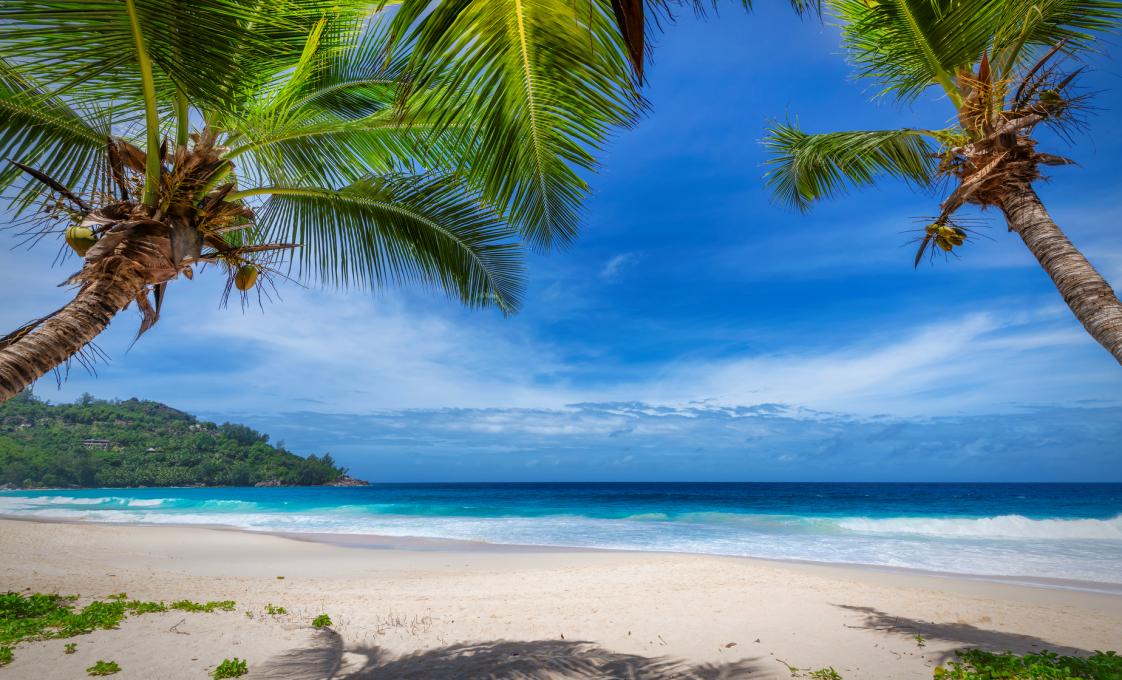
If you are looking forward to lying under a palm tree on a comfortable lounger accompanied by a delicious cocktail in hand listening to music or want to sunbathe on white sand beaches next to crystal clear, turquoise blue water that only the Caribbean can offer, this is the beach break for you!
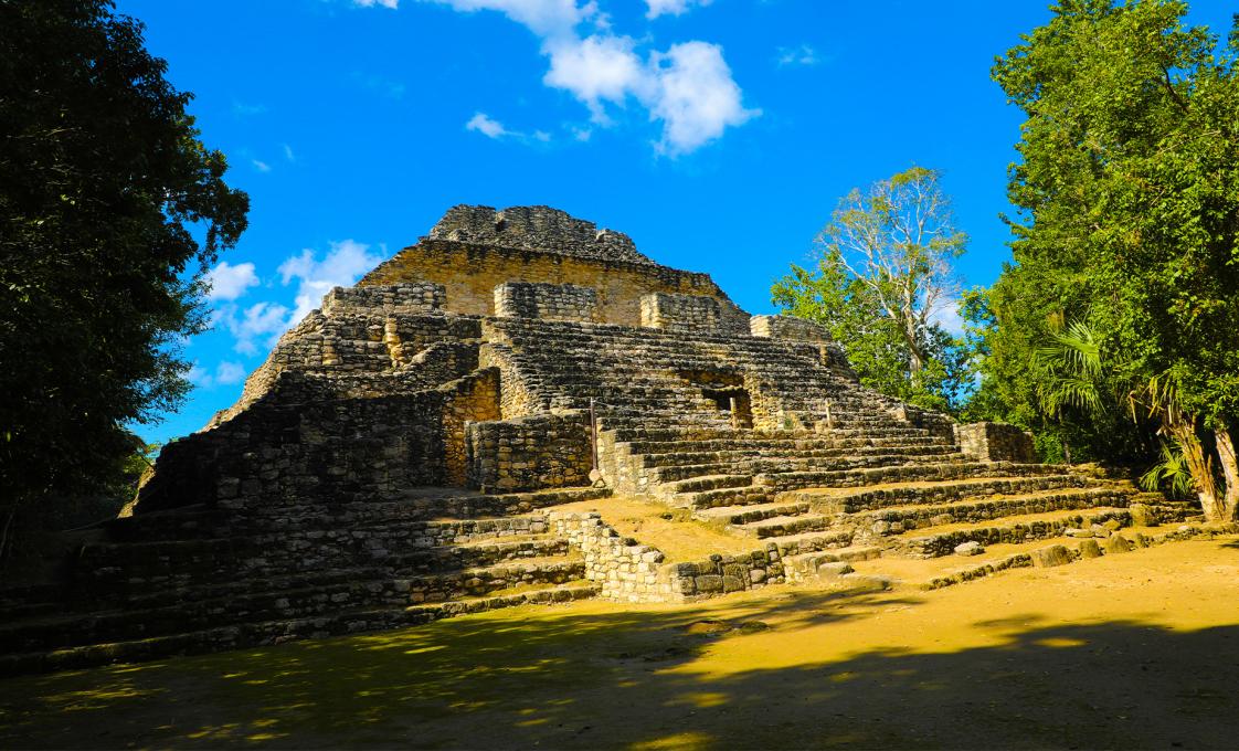
Explore the fascinating Chacchoben Mayan ruins and then refresh yourself in the crystal clear waters of the Seven Color Lagoon.
VoyagePro may earn a commission if you book through these links, at no extra cost to you.
Place photos are resized for display and cropped where needed.
