New Zealand Cruise Association – Bay of Islands
The official profile treats Bay of Islands as one anchorage destination with call-specific passenger tender landings.


Cruise planning
Use the timetable to see upcoming cruise ship calls, busy-day signals, ship counts, and port context alongside the guide, map, weather, and readiness tools.
Schedule note
Port schedules can change because of weather, berth availability, itinerary updates, and operational decisions. Verify important times with your cruise line or the port authority before travel.
Country, code, and on-shore essentials.
New Zealand
NZBOI
-35.184, 174.165
Hotel search loads here when you reach this section.
VoyagePro may earn a commission if you book through Expedia, at no extra cost to you.
Bay of Islands is an exact passenger arrival with call-specific port, transfer, and return-time requirements.
Before going ashore, confirm the berth or tender point, local time, all-aboard deadline, and the meeting location for any independently booked transport or tour.
Usually tenders
Walkable
Choose one local plan or one properly timed regional excursion rather than combining uncertain transport links.
This port works best when you confirm the exact arrival point, choose one coherent plan, and protect the return to the ship with a comfortable time buffer.
Best for
Needs extra planning when
This section draws on information from New Zealand Cruise Association – Bay of Islands.
Confirm the actual berth first—local access can change substantially between terminals.
Ships anchor in the Bay of Islands and tender to the call's designated landing, commonly near Waitangi or Paihia; those labels are not separate cruise events.
Paihia and Waitangi are local from their respective landings; Russell, Kerikeri, and wider Northland require ferry, shuttle, or booked transport.
Do not assume a shuttle; use only a port or ship service announced for the exact berth or tender landing.
Use only the marked passenger pickup area and prebook scarce or accessible vehicles.
This section draws on information from New Zealand Cruise Association – Bay of Islands.
A concise summary of useful details found in port, municipal, transport, terminal, and tourism material.
New Zealand Cruise Association – Bay of Islands
The official profile treats Bay of Islands as one anchorage destination with call-specific passenger tender landings.
This section draws on information from New Zealand Cruise Association – Bay of Islands.
Start with the usable time you have ashore, then leave a comfortable return margin.
Quick call
Independent exploration is practical only after confirming the exact landing and protecting the ship return time.
Half day
Waitangi Treaty Grounds, Paihia, Russell, island cruises, Kerikeri, and Māori cultural experiences are the main choices. Paihia and Waitangi are local from their respective landings; Russell, Kerikeri, and wider Northland require ferry, shuttle, or booked transport.
Long call
Waitangi Treaty Grounds, Paihia, Russell, island cruises, Kerikeri, and Māori cultural experiences are the main choices. Keep the ship's all-aboard time as a hard deadline and allow extra time for weather, traffic, queues, security, or tender operations.
This section draws on information from New Zealand Cruise Association – Bay of Islands.
Tender steps, landing assignment, ferry ramps, heat, and uneven historic grounds require call-specific accessibility checks.
This section draws on information from New Zealand Cruise Association – Bay of Islands.
Keep the ship's all-aboard time as a hard deadline and allow extra time for weather, traffic, queues, security, or tender operations.
This section draws on information from New Zealand Cruise Association – Bay of Islands.
These answers use the reviewed operational fields above; check the linked source when a detail affects a booking or transfer.
Ships anchor in the Bay of Islands and tender to the call's designated landing, commonly near Waitangi or Paihia; those labels are not separate cruise events.
Paihia and Waitangi are local from their respective landings; Russell, Kerikeri, and wider Northland require ferry, shuttle, or booked transport.
Do not assume a shuttle; use only a port or ship service announced for the exact berth or tender landing. Use only the marked passenger pickup area and prebook scarce or accessible vehicles.
Choose one local plan or one properly timed regional excursion rather than combining uncertain transport links.
This section draws on information from New Zealand Cruise Association – Bay of Islands.
Guide review and sources
Operational details can change by berth, weather, and ship call. Confirm important arrangements before travel.
Choose a few places that fit your time ashore, then check access and transport before setting out.
Paihia and Waitangi are local from their respective landings; Russell, Kerikeri, and wider Northland require ferry, shuttle, or booked transport.
Arrival location reference

Local landmark
A source-backed option to consider for a port day in Bay of Islands.
A source-backed option to consider for a port day in Bay of Islands. Check current access, opening hours, admission requirements, and reservations before setting out.
Treat this as a longer outing and protect the ship return with confirmed transport and a generous time margin.
Longer outing; confirmed transport recommended
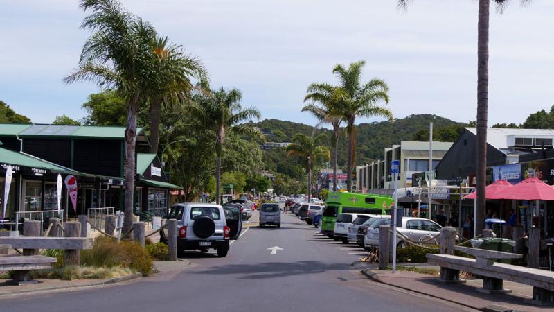
Local landmark
A source-backed option to consider for a port day in Bay of Islands.
A source-backed option to consider for a port day in Bay of Islands. Check current access, opening hours, admission requirements, and reservations before setting out.
Treat this as a longer outing and protect the ship return with confirmed transport and a generous time margin.
Longer outing; confirmed transport recommended

Local landmark
A source-backed option to consider for a port day in Bay of Islands.
A source-backed option to consider for a port day in Bay of Islands. Check current access, opening hours, admission requirements, and reservations before setting out.
Plan local transport from the assigned terminal or landing rather than assuming this stop is walkable.
Local transport may be needed from the arrival point
Coastal landmark
A source-backed option to consider for a port day in Bay of Islands.
A source-backed option to consider for a port day in Bay of Islands. Check current access, opening hours, admission requirements, and reservations before setting out.
Use the official visitor information for directions. No sufficiently reliable geotagged match was found, so this place is intentionally not pinned.

Local landmark
A source-backed option to consider for a port day in Bay of Islands.
A source-backed option to consider for a port day in Bay of Islands. Check current access, opening hours, admission requirements, and reservations before setting out.
Treat this as a longer outing and protect the ship return with confirmed transport and a generous time margin.
Longer outing; confirmed transport recommended
Local landmark
A source-backed option to consider for a port day in Bay of Islands.
A source-backed option to consider for a port day in Bay of Islands. Check current access, opening hours, admission requirements, and reservations before setting out.
Use the official visitor information for directions. No sufficiently reliable geotagged match was found, so this place is intentionally not pinned.
Reviewed 2026-07-25. Location placement, transport, and attraction information retain separate sources so each can be checked and updated independently.
Choose an upcoming call and ship to turn the published schedule into a practical planning window.
Choose a call date
Choose your ship

Your selected call
Arrival
7:00am
Departure
5:00pm
Scheduled window
10h
Planning return buffer
Count back from the published departure time.
Planning checkpoint: 3:30pm
This is a personal planning checkpoint, not the ship's official all-aboard time. Always follow the time and instructions issued onboard.
Guide match for this window
A longer outing may fit, but protect the return journey from weather, traffic, queues, and tender delays.
Dates, ships, and times come from the currently published cruise-call records. Schedules can change, and passenger totals represent available ship-capacity data rather than a forecast of people going ashore.
The Tasman Sea on the west and the Pacific Ocean on the east meet at thetop of North Island at Cape Reinga. No matter what route you take, you'll passfarms and forests, marvellous beaches, and great open spaces. The East Coast,up to the Bay of Islands, is Northland's most densely populated, often withrefugees from bigger cities—looking for a more relaxed life—clustered aroundbreathtaking beaches. The first decision on the drive north comes at the footof the Brynderwyn Hills.
Turning left will take you up the West Coast throughareas once covered with forests and now used for either agricultural orhorticulture. Driving over "the Brynderwyns," as they are known,takes you to Whangarei, the only city in Northland. If you're in the mood for adiversion, you can slip to the beautiful coastline and take in Waipu Cove, anarea settled by Scots, and Laings Beach, where million-dollar homes sit next tosmall Kiwi beach houses. An hour's drive farther north is the Bay of Islands, known all over theworld for its beauty.
There you will find lush forests, splendid beaches, andshimmering harbors. The Treaty of Waitangi was signed here in 1840 betweenMāoriand the British Crown, establishing the basis for the modern New Zealandstate. Every year on February 6, the extremely beautiful Waitangi Treaty Ground(the name means weeping waters) is the sight of a celebration of the treaty andprotests by Māori unhappy with it. Continuing north on the East Coast, theagricultural backbone of the region is even more evident and a series ofwinding loop roads off the main highway will take you to beaches that are bothbeautiful and isolated where you can swim, dive, picnic, or just laze. .
The West Coast is even less populated, and the coastline is rugged andwindswept. In the Waipoua Forest, you will find some of New Zealand's oldestand largest kauri trees; the winding road will also take you past mangroveswamps. Crowning the region is the spiritually significant Cape Reinga, theheadland at the top of the vast stretch of 90 Mile Beach, where it's believedMāori souls depart after death. Today Māori make up roughly a quarter of thearea's population (compared with the national average of about 15%).
The legendaryMāori navigator Kupe was said to have landed on the shores of Hokianga Harbour,where the first arrivals made their home. Many different wi (tribes) livedthroughout Northland, including Ngapuhi (the largest), Te Roroa, Ngati Wai,Ngati Kuri, Te Aupouri, Ngaitakoto, Ngati Kahu, and Te Rarawa. Many Māoriherecan trace their ancestry to the earliest inhabitants
 eSIM for travellers
Use a GigSky travel eSIM for maps, messaging, and travel updates ashore. Choose a plan that covers the countries you will visit.
Land plans do not include at-sea coverage. Check destination coverage and phone compatibility before buying.
VoyagePro may earn a commission if you buy through this link, at no extra cost to you.
Explore tour options for your port day. Check the meeting point and return time against your ship’s schedule before booking.
No tours were returned for this port.
Check current options with Shore Excursions Group. Tours and availability can change.
VoyagePro may earn a commission if you book through these links, at no extra cost to you.
Place photos are resized for display and cropped where needed.