U.S. Virgin Islands Department of Tourism – St. Thomas
The official USVI guide identifies St. Thomas sightseeing, beaches, historic sites, and boat access to Hassel Island.


Cruise planning
Use the timetable to see upcoming cruise ship calls, busy-day signals, ship counts, and port context alongside the guide, map, weather, and readiness tools.
Schedule note
Port schedules can change because of weather, berth availability, itinerary updates, and operational decisions. Verify important times with your cruise line or the port authority before travel.
Country, code, and on-shore essentials.
U.S. Virgin Islands
VISTT
18.335, -64.953
Hotel search loads here when you reach this section.
VoyagePro may earn a commission if you book through Expedia, at no extra cost to you.


Saint Thomas is a major U.S. Virgin Islands cruise stop with dock areas, Charlotte Amalie access, beaches, and island sightseeing linked by road.
Before going ashore, confirm the berth or tender point, local time, all-aboard deadline, and the meeting location for any independently booked transport or tour.
Varies by call
Varies by terminal
An independent visit can work for a defined Charlotte Amalie or beach plan with transport agreed in advance; keep the route simple on a short call.
This port works best when you confirm the exact arrival point, choose one coherent plan, and protect the return to the ship with a comfortable time buffer.
Best for
Needs extra planning when
This section draws on information from U.S. Virgin Islands Department of Tourism – St. Thomas.
Confirm the actual berth first—local access can change substantially between terminals.
St. Thomas ships commonly use Havensight/WICO or Crown Bay, and the two terminals are several kilometres apart. Check the berth name before arranging pickup or deciding to walk into Charlotte Amalie.
From Havensight, central Charlotte Amalie is roughly 2 km away, often a 25–35 minute waterfront walk or short taxi ride. Crown Bay is farther west and normally needs a taxi; beaches, viewpoints, and ferries require road or boat transport.
Charlotte Amalie, beaches, and scenic viewpoints are reached by walking, taxi, tour vehicle, or ferry depending on the plan.
Charlotte Amalie, beaches, and scenic viewpoints are reached by walking, taxi, tour vehicle, or ferry depending on the plan.
This section draws on information from U.S. Virgin Islands Department of Tourism – St. Thomas.
A concise summary of useful details found in port, municipal, transport, terminal, and tourism material.
U.S. Virgin Islands Department of Tourism – St. Thomas
The official USVI guide identifies St. Thomas sightseeing, beaches, historic sites, and boat access to Hassel Island.
This section draws on information from U.S. Virgin Islands Department of Tourism – St. Thomas.
Start with the usable time you have ashore, then leave a comfortable return margin.
Quick call
Keep the day close to the port and choose one or two reliable nearby stops.
Half day
Charlotte Amalie, Magens Bay, waterfront shopping, historic sites, and island viewpoints are principal planning anchors. From Havensight, central Charlotte Amalie is roughly 2 km away, often a 25–35 minute waterfront walk or short taxi ride. Crown Bay is farther west and normally needs a taxi; beaches, viewpoints, and ferries require road or boat transport.
Long call
Charlotte Amalie, Magens Bay, waterfront shopping, historic sites, and island viewpoints are principal planning anchors. Keep the ship's all-aboard time as a hard deadline and allow extra time for weather, traffic, queues, security, or tender operations.
This section draws on information from U.S. Virgin Islands Department of Tourism – St. Thomas.
Pier ramps, steep island roads, heat, and beach terrain can affect access; confirm vehicle and beach accessibility directly.
This section draws on information from U.S. Virgin Islands Department of Tourism – St. Thomas.
Keep the ship's all-aboard time as a hard deadline and allow extra time for weather, traffic, queues, security, or tender operations.
This section draws on information from U.S. Virgin Islands Department of Tourism – St. Thomas.
These answers use the reviewed operational fields above; check the linked source when a detail affects a booking or transfer.
St. Thomas ships commonly use Havensight/WICO or Crown Bay, and the two terminals are several kilometres apart. Check the berth name before arranging pickup or deciding to walk into Charlotte Amalie.
From Havensight, central Charlotte Amalie is roughly 2 km away, often a 25–35 minute waterfront walk or short taxi ride. Crown Bay is farther west and normally needs a taxi; beaches, viewpoints, and ferries require road or boat transport.
Charlotte Amalie, beaches, and scenic viewpoints are reached by walking, taxi, tour vehicle, or ferry depending on the plan.
An independent visit can work for a defined Charlotte Amalie or beach plan with transport agreed in advance; keep the route simple on a short call.
This section draws on information from U.S. Virgin Islands Department of Tourism – St. Thomas.
Guide review and sources
Operational details can change by berth, weather, and ship call. Confirm important arrangements before travel.
Choose a few places that fit your time ashore, then check access and transport before setting out.
From Havensight, central Charlotte Amalie is roughly 2 km away, often a 25–35 minute waterfront walk or short taxi ride. Crown Bay is farther west and normally needs a taxi; beaches, viewpoints, and ferries require road or boat transport.
Arrival location reference
Historic site
A mapped historic site to consider for a port day in Saint Thomas.
A mapped historic site to consider for a port day in Saint Thomas. Check current access, opening hours, admission requirements, and reservations before setting out.
This is near the destination reference, but the practical walking route still depends on the assigned berth or tender landing.
Near the destination reference; confirm the walking route

Religious landmark
A mapped religious landmark to consider for a port day in Saint Thomas.
A mapped religious landmark to consider for a port day in Saint Thomas. Check current access, opening hours, admission requirements, and reservations before setting out.
Plan local transport from the assigned terminal or landing rather than assuming this stop is walkable.
Local transport may be needed from the arrival point

Historic site
A mapped historic site to consider for a port day in Saint Thomas.
A mapped historic site to consider for a port day in Saint Thomas. Check current access, opening hours, admission requirements, and reservations before setting out.
Plan local transport from the assigned terminal or landing rather than assuming this stop is walkable.
Local transport may be needed from the arrival point

Nature and park
A mapped nature and park to consider for a port day in Saint Thomas.
A mapped nature and park to consider for a port day in Saint Thomas. Check current access, opening hours, admission requirements, and reservations before setting out.
Plan local transport from the assigned terminal or landing rather than assuming this stop is walkable.
Local transport may be needed from the arrival point

Historic site
A source-backed option to consider for a port day in Saint Thomas.
A source-backed option to consider for a port day in Saint Thomas. Check current access, opening hours, admission requirements, and reservations before setting out.
Plan local transport from the assigned terminal or landing rather than assuming this stop is walkable.
Local transport may be needed from the arrival point
Local landmark
A source-backed option to consider for a port day in Saint Thomas.
A source-backed option to consider for a port day in Saint Thomas. Check current access, opening hours, admission requirements, and reservations before setting out.
Plan local transport from the assigned terminal or landing rather than assuming this stop is walkable.
Local transport may be needed from the arrival point
Reviewed 2026-07-25. Location placement, transport, and attraction information retain separate sources so each can be checked and updated independently.
Choose an upcoming call and ship to turn the published schedule into a practical planning window.
Choose a call date
Choose your ship

Your selected call
Arrival
8:00am
Departure
4:00pm
Scheduled window
8h
Planning return buffer
Count back from the published departure time.
Planning checkpoint: 2:30pm
This is a personal planning checkpoint, not the ship's official all-aboard time. Always follow the time and instructions issued onboard.
Guide match for this window
A longer outing may fit, but protect the return journey from weather, traffic, queues, and tender delays.
Dates, ships, and times come from the currently published cruise-call records. Schedules can change, and passenger totals represent available ship-capacity data rather than a forecast of people going ashore.
If you fly to the 32-square-mile (83-square-km) island of St. Thomas, you land at its western end; if you arrive by cruise ship, you come into one of the world's most beautiful harbors. Either way, one of your first sights is the town of Charlotte Amalie. From the harbor you see an idyllic-looking village that spreads into the lower hills. If you were expecting a quiet hamlet with its inhabitants hanging out under palm trees, you've missed that era by about 300 years.
Although other islands in the USVI developed plantation economies, St. Thomas cultivated its harbor, and it became a thriving seaport soon after it was settled by the Danish in the 1600s. The success of the naturally perfect harbor was enhanced by the fact that the Danes—who ruled St. Thomas with only a couple of short interruptions from 1666 to 1917—avoided involvement in some 100 years' worth of European wars. Denmark was the only European country with colonies in the Caribbean to stay neutral during the War of the Spanish Succession in the early 1700s. Thus, products of the Dutch, English, and French islands—sugar, cotton, and indigo—were traded through Charlotte Amalie, along with the regular shipments of slaves. When the Spanish wars ended, trade fell off, but by the end of the 1700s Europe was at war again, Denmark again remained neutral, and St. Thomas continued to prosper. Even into the 1800s, while the economies of St. Croix and St. John foundered with the market for sugarcane, St. Thomas's economy remained vigorous.
This prosperity led to the development of shipyards, a well-organized banking system, and a large merchant class. In 1845 Charlotte Amalie had 101 large importing houses owned by the English, French, Germans, Haitians, Spaniards, Americans, Sephardim, and Danes. Charlotte Amalie is still one of the world's most active cruise-ship ports. On almost any day at least one and sometimes as many as eight cruise ships are tied to the docks or anchored outside the harbor.
Gently rocking in the shadows of these giant floating hotels are just about every other kind of vessel imaginable: sleek sailing catamarans that will take you on a sunset cruise complete with rum punch and a Jimmy Buffett soundtrack, private megayachts for billionaires, and barnacle-bottom sloops—with laundry draped over the lifelines—that are home to world-cruising gypsies. Huge container ships pull up in Sub Base, west of the harbor, bringing in everything from breakfast cereals to tires. Anchored right along the waterfront are down-island barges that ply the waters between the Greater Antilles and the Leeward Islands, transporting goods such as refrigerators, VCRs, and disposable diapers. The waterfront road through Charlotte Amalie was once part of the harbor.
Before it was filled in to build the highway, the beach came right up to the back door of the warehouses that now line the thoroughfare. Two hundred years ago those warehouses were filled with indigo, tobacco, and cotton. Today the stone buildings house silk, crystal, and diamonds. Exotic fragrances are still traded, but by island beauty queens in air-conditioned perfume palaces instead of through open market stalls.
The pirates of old used St. Thomas as a base from which to raid merchant ships of every nation, though they were particularly fond of the gold- and silver-laden treasure ships heading to Spain. Pirates are still around, but today's versions use St. Thomas as a drop-off for their contraband: illegal immigrants and drugs. To explore outside Charlotte Amalie, rent a car or hire a taxi. Your rental car should come with a good map; if not, pick up the pocket-size "St. Thomas–St. John Road Map" at a tourist information center.
Roads are marked with route numbers, but they're confusing and seem to switch numbers suddenly. Roads are also identified by signs bearing the St. Thomas–St. John Hotel and Tourism Association's mascot, Tommy the Starfish. More than 100 of these color-coded signs line the island's main routes. Orange signs trace the route from the airport to Red Hook, green signs identify the road from town to Magens Bay, Tommy's face on a yellow background points from Mafolie to Crown Bay through the north side, red signs lead from Smith Bay to Four Corners via Skyline Drive, and blue signs mark the route from the cruise-ship dock at Havensight to Red Hook.
These color-coded routes are not marked on most visitor maps, however. Allow yourself a day to explore, especially if you want to stop to take pictures or to enjoy a light bite or refreshing swim. Most gas stations are on the island's more populated eastern end, so fill up before heading to the north side. And remember to drive on the left!
Keep exploring
 eSIM for travellers
Use a GigSky travel eSIM for maps, messaging, and travel updates ashore. Choose a plan that covers the countries you will visit.
Land plans do not include at-sea coverage. Check destination coverage and phone compatibility before buying.
VoyagePro may earn a commission if you buy through this link, at no extra cost to you.
Explore tour options for your port day. Check the meeting point and return time against your ship’s schedule before booking.
Excursion partner

Independent shore excursions
Select any tour card to view current details, availability, and booking on the Shore Excursions Group website.
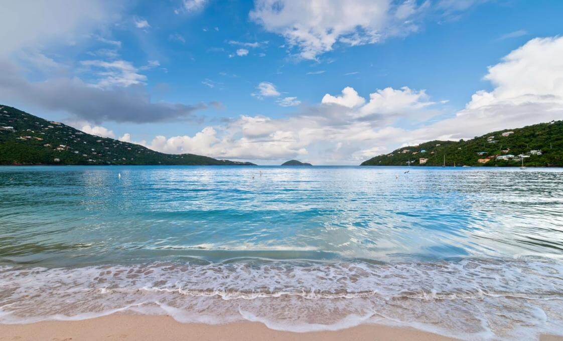
Experience the best of St. Thomas with a relaxing beach day that includes kayaking, stand-up paddleboarding, and Hobie Cat sailing, offering exciting water sports on the crystal-clear Caribbean Sea. Whether you prefer exploring vibrant coral reefs with snorkel gear or simply lounging on the pristine beach, this tour provides the perfect blend of adventure and relaxation for all ages.

For guests who have never gone diving, here is the chance to experience the thrill of being underwater and visiting a live reef.

A great dive for newly certified divers or as a refresher dive in the beauty of St. Thomas's undersea world.
VoyagePro may earn a commission if you book through these links, at no extra cost to you.
Place photos are resized for display and cropped where needed.


